Kaʻena Point Trail: The Complete Guide

Kaʻena Point Trail is one of the most beautiful coastal hikes on Oahu. It sits at the wild, quiet edge of the island, far away from the crowds of Waikiki. You will see blue water, tide pools, seals, and rare birds along the way. This guide covers everything about the Kaena point trail. You will learn the distance, the difficulty, the best time to go, and safety tips that most other guides forget to mention.
If you are planning a trip and want an easy hike with big views, check out our full list of Oahu hikes for more ideas. But this one trail deserves its own guide, since it is different from almost every other hike on the island. It has no steep hills, no jungle mud, and no crowded lookout points. It is simply a long, open walk beside the ocean.
What Is Kaʻena Point Trail?
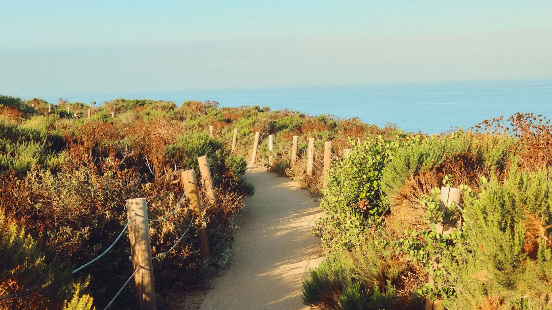
Kaena point trail sits at the northwest tip of Oahu, where the island comes to a sharp, rocky point. It is part of Kaʻena Point State Park. The trail follows an old railroad path that once carried sugar cane trains across this side of the island. That railroad closed many years ago, and today the same flat path carries hikers instead of trains. You can still spot pieces of the old track and old wooden posts along the way if you look closely.
The best part of the trail is the Kaʻena Point Natural Area Reserve, found right at the tip of the point. This is a real bird sanctuary, not just a scenic overlook. Rare Laysan albatross nest here every winter, and you can often watch them glide low over the grass or perform their strange mating dance. You may also see Hawaiian monk seals resting on the sand near the water. These seals are one of the rarest marine mammals in the world, and Oahu is one of the few places left where you can see them in the wild.
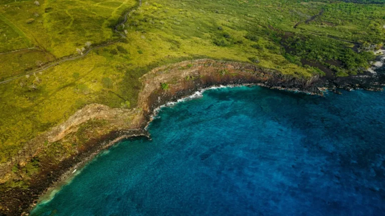
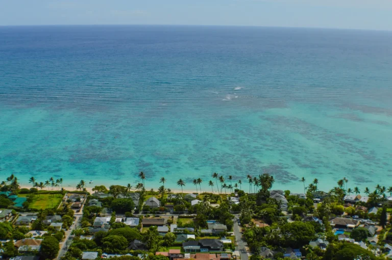
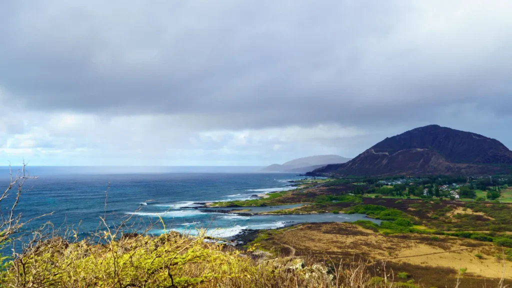
The whole park sits along the coast, so you get ocean views for the entire walk. On a clear day, the water shifts between deep blue and bright turquoise, and waves crash hard against the black volcanic rock. This is a very different kind of Hawaii than the postcard beaches most tourists picture.
Where Is Kaena Point? (Location)
Kaʻena point oahu sits at the far corner where the North Shore meets the Waianae Coast. No paved road connects the two sides of the island here, which is part of why the area still feels wild and untouched. Most of Oahu has been built up over the years, but this corner has stayed mostly the same for decades. There are two main ways to reach the point.
The first is the Waianae side, also called the South Route, which starts near Yokohama Bay on the west side of the island. The second is the Mokuleia side, or the North Route, which begins at the very end of Farrington Highway on the North Shore. These two trailheads do not connect by any road. If you park at one side, you cannot simply drive to the other. Each side gives hikers a different path that eventually meets at the same point, right at the tip of the island.
Which Kaena Point Hike Is Better?
This is one of the most common questions hikers ask before their trip, and the honest answer is that it depends on what kind of walk you want.
The Waianae route, on the south side, tends to feel more open, with wider ocean views for most of the walk. It sits closer to the albatross sanctuary, so bird sightings often start earlier on this side. It is also a strong choice for whale watching during the winter months, since the water here stays calm and clear on most days.
Yokohama Bay, right at the start of this route, has restrooms and a lifeguard on duty, which makes it a more comfortable starting point for families. Because more visitors use this side, it can feel a bit busier, especially on weekends and around sunset. The Mokuleia route, on the north side, feels quieter and more remote.
Fewer hikers use this trailhead, so you are more likely to have long stretches of the trail to yourself. The views lean toward the Waianae mountain range rising behind you, rather than open ocean the whole way. The ground here also has more sand and dunes, which can make the walk feel slightly longer even though the distance is close to the same. If your main goal is peace and quiet, this side usually wins.

Neither side is truly better in every way. If wildlife and wide ocean views matter most to you, pick the south route from Waianae. If you want fewer people and a slower, calmer walk, pick the north route from Mokuleia.
Kaena Point Trail Distance and Difficulty
State park data shows the trail runs about 2.5 miles each way from either trailhead to the point. That puts the full round trip at close to 5 miles total. Some hikers track their walk closer to 5.5 miles on GPS running apps, which usually happens if they wander down side paths near the shore or follow every curve of the old road instead of the straightest line.
When we hiked the Mokuleʻia side ourselves, our GPS logged closer to 5.4 miles round trip, mostly because we kept stepping off the main path to check out tide pools and look for monk seals resting near the water. In terms of difficulty, the state park lists this trail as “Moderate,” but most hikers who finish it describe it as fairly easy.
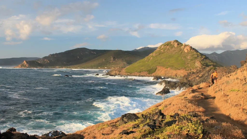
There is almost no elevation gain along the entire route, so you are not climbing hills at any point. The moderate rating mostly comes down to three things: the ground turns rocky and sandy in different sections, there is no shade anywhere along the trail, and coastal wind can pick up strongly, especially in the afternoon. None of these make the hike dangerous, but they do make it feel more tiring than a flat walk in the city would.
Even first-time hikers, older visitors, and families with older kids can usually complete this trail without much trouble. The main things you need are decent walking shoes and enough water for a few hours in the sun.
How Long Does It Take to Hike Kaena Point?
Most people finish the full round trip in two to three hours, though your exact time depends on how many stops you make along the way. Hikers moving at a fast, steady pace with no breaks often finish in about two hours. Most casual walkers, especially those stopping for photos, tide pools, or wildlife, take closer to two and a half to three hours. If you plan to add the pillbox side trail near the point, add another thirty to forty-five minutes to your total time.
Since the trail stays flat the whole way, it takes far less time and energy than hikes with real elevation gain, like the Koko Head Trail, where every step involves climbing.
Kaena Point Weather and Best Time to Visit
Kaena point weather stays warm and dry through most of the year, since this part of Oahu sits in one of the driest pockets on the island. Rain here is rare compared to the North Shore or windward side. Still, sun exposure is the real challenge on this trail, so timing your visit matters more than checking for rain.
Early morning, right around sunrise, is one of the best times to start this hike. The air stays cooler, the light is soft, and far fewer people are on the trail at that hour. Late afternoon, closer to sunset, is the other strong option, since the heat drops and the light turns golden over the water.
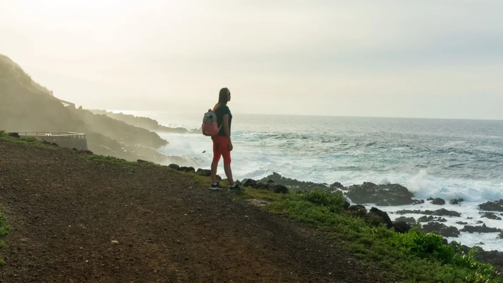
Midday hours, roughly between eleven and three, are worth avoiding if you can, since there is no shade anywhere and the sun feels much stronger by the water. For help planning the right season for your whole trip, see our guide on the best time to visit Oahu.
Winter also brings one more reason to visit. From December through May, humpback whales pass close to this coastline, and hikers often spot them breaching from the trail itself. We saw two whales breach from the Waianae side during a late-afternoon hike in February, right as the light started to turn gold.
What to Bring and Safety Tips
Because this trail has no shade and no shelter of any kind, packing the right gear matters more here than on most Oahu hikes. Bring plenty of water, at least one liter per person, since you cannot refill anywhere along the route. Sunscreen and a hat will protect you from the strong, direct sun, and closed-toe shoes are worth wearing since the path turns rocky in several sections.
A few snacks or a light lunch can also help if you plan to stay out for the full three hours. If you are hiking toward sunset, bring a flashlight or use your phone light, since the walk back to your car will happen in the dark. Car break-ins have been reported at both trailhead parking areas, so lock your car before you start walking and avoid leaving valuables inside, even in the trunk.
Kaena Point Access and Permit Info
This part gets skipped in most other guides, so it deserves extra attention here. The good news for most visitors is simple: if you are just hiking, you almost certainly do not need a permit at all. The Vehicle Access Special Use Permit only applies to people who want to drive a car or truck past the locked gate and onto the dirt roads inside the Mokuleʻia section.
This permit exists mainly for local fishermen and residents with high-clearance vehicles, not for tourists visiting for a day hike. It is free, but the application takes about ten business days to process, and it comes with a rotating gate combination that changes weekly, so it is not something you can arrange last minute for a vacation.
For almost every visitor, the simple plan is this: park in the regular lot outside or near the gate, then walk in on foot. Walking in never requires a permit, no matter which trailhead you use. The gate at the Waianae side closes at 7 PM each evening, so if you plan to hike this route, especially near sunset, park outside the gate rather than inside it. This keeps your car from getting locked in overnight if your hike runs later than expected.
It is also worth checking conditions before you drive out, since parts of the trail, including the Keawaʻula section on the south side, sometimes close for maintenance work or after heavy weather. A quick check of the official Hawaii State Parks website before you leave can save you a wasted trip.
Wildlife: What Will You See?
Kaena point earns its reputation for more than just scenery. Laysan albatross nest here through the winter months, and their size alone makes them impressive to watch up close, whether they are gliding low over the grass or performing their odd, jerky mating dance on the ground. Hawaiian monk seals also show up along the shoreline fairly often.
These seals are endangered, and only around fifteen hundred are estimated to exist in the wild, so spotting one resting on the sand here is a genuinely rare experience. If you do see one, keep at least fifty feet of distance and never approach for a photo.
Humpback whales pass offshore from December through May, often visible as dark shapes breaching in the distance. Spinner dolphins also appear from time to time, usually early in the morning when the water stays calmer.
To reach the reserve at the tip of the point, hikers pass through a predator-proof fence built to protect the nesting birds from dogs, rats, and other animals that would otherwise threaten their eggs and chicks. Because of this fence, dogs are not allowed past that point, even on a leash.
Kaena Point Trail Photos: What to Capture
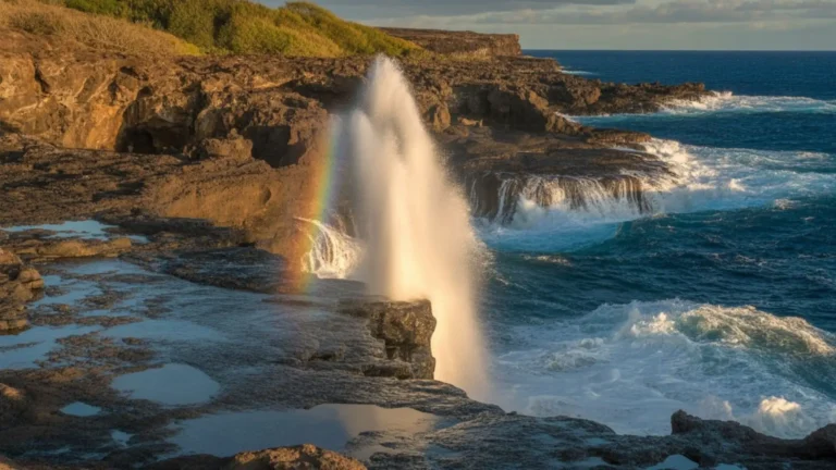
Photographers tend to gather a similar set of shots on this trail, and for good reason, since the scenery changes noticeably from one stretch to the next. The remains of the old railroad track make an interesting foreground near the start of the walk. Small blowholes along the south route shoot water into the air when waves hit just right.
Tide pools and dark volcanic rock line much of the shoreline, especially on calmer mornings. The north route offers wide sand dunes that catch beautiful light in the late afternoon. And of course, the sunset itself, with the sun dropping straight into open ocean, is the shot most people come here for. From the pillbox above the point, you also get a rare aerial-style view down over the entire reserve.
Golden hour, in the hour before sunset, consistently gives the softest and most flattering light here.
Kaena Point Pillbox: A Bonus Adventure
Hikers looking for a bit more of a challenge often add the pillbox trail onto their day. This rocky side path climbs up to an old World War II bunker overlooking the point. From the top, you get a full view down onto Kaena Point and the surrounding coastline, along with one of the best sunset viewpoints on this side of the island.
This extra climb feels harder than it looks on paper, mostly because you have already walked the full main trail before starting it. Still, most hikers who make the climb say the view from the top makes the extra effort worthwhile. If pillbox-style hikes appeal to you, Oahu has several similar options worth checking out, including the Lanikai Pillbox, the Pink Pillbox, and the Ehukai Pillbox trails.
Is Kaena Point Worth It?
The short answer is yes, and most visitors who make the trip agree once they arrive. This remains one of the last truly untouched, peaceful corners of Oahu, largely because it sits far from the main roads and resorts that cover most of the island. The flat, gentle trail makes it approachable for families, older hikers, and beginners who might struggle on steeper trails elsewhere on the island.
You also get a real chance to see rare wildlife here that you simply will not find on most other Oahu trails, from nesting albatross to resting monk seals. Sunset views along this stretch of coast rank among the best on the island, and entry itself costs nothing, aside from the optional vehicle permit if you want to drive past the gate.
If your goal is to step away from crowded tourist spots and see a wilder, quieter side of Hawaii, Kaena Point delivers exactly that.
What’s the Easiest Hike in Oahu?
Oahu offers many well-known hikes, including Diamond Head, Koko Head, and Manoa Falls, and most of these involve steep climbs or steady elevation gain from start to finish. Kaena Point Trail stands apart from these because it has almost no elevation gain at all, despite being one of the longer hikes on the island by distance.
| Hike | Distance | Elevation Gain | Difficulty |
|---|---|---|---|
| Kaena Point Trail | ~5 miles | Almost none | Easy-Moderate |
| Diamond Head | ~1.6 miles | ~560 ft | Moderate |
| Koko Head | ~1.8 miles | ~1000+ ft | Hard |
| Manoa Falls | ~1.6 miles | ~400 ft | Easy-Moderate |
This comparison highlights something worth remembering. Kaena Point covers the most ground of the four, yet it remains the easiest on your legs and lungs, since the entire walk stays flat. You spend your energy walking forward rather than climbing upward, which is exactly why so many people call it one of the easiest long hikes on the island. For more flat, easy walks on this side of Oahu, our North Shore Oahu hikes guide covers several more options nearby.
Final Thoughts
Kaʻena point trail stands out as one of the true hidden gems left on Oahu. This hike stays easy for most fitness levels, yet it still delivers stunning coastal views, genuine wildlife encounters, and a calm, quiet setting you rarely find elsewhere on the island. Whether you choose to start from the Waianae side or the Mokuleia side, both routes lead you toward a trip you are unlikely to forget.
If you are putting together your Oahu itinerary, add the Kaena point hike to your list early, since it pairs well with an early morning or sunset visit. Bring enough water, wear sunscreen, and choose comfortable shoes, and the trail itself will take care of the rest.
Frequently Asked Questions
The trail runs about 2.5 miles each way from either trailhead, which adds up to roughly 5 miles for the full round trip.
Yes, the flat, gentle ground makes it a solid choice for families with older kids, since there is no climbing involved.
You can bring dogs on the main trail itself, but they are not allowed past the predator-proof fence into the protected bird reserve.
Early morning or the hour right before sunset works best, since the sun feels far less harsh during those windows than it does at midday.