The Ultimate Oahu Surf Forecast Guide: Read Wave Charts Like a Local

Surfing on Oahu is not just a sport. It is a daily conversation with the Pacific Ocean. Some days, the sea whispers smooth, gentle waves perfect for beginners. Other days, it roars with massive, powerful swells that demand absolute respect.
If you want to score the best waves and stay safe, you must know how to read the Oahu surf forecast. Checking the surf report ensures you show up at the right beach, at the right hour, with the right surfboard.
This comprehensive guide breaks down the Oahu surf forecast in a clear, practical, and human way. No confusing jargon. No fake data. Just real, actionable surf knowledge backed by trusted oceanographic sources like NOAA and the National Weather Service.
Why the Oahu Surf Forecast Matters (More Than You Think)
Many beginners think surf forecasting is optional. They pack their wax, grab a board, and drive to the nearest beach. Seasoned watermen and locals know better.
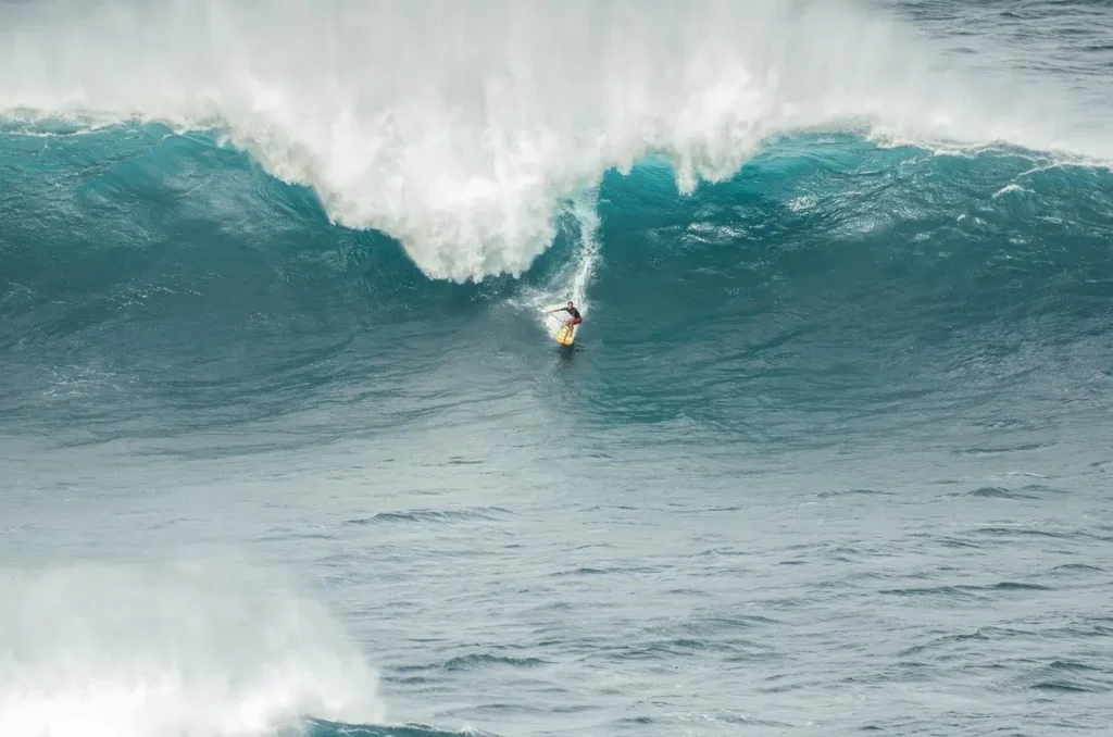
A precise Oahu surf report helps you:
- Avoid Dangerous Conditions: Oahu waves hold immense power. A sudden swell can turn a calm bay into a washing machine of dangerous currents.
- Choose the Perfect Surf Spot: Oahu has four distinct coasts. When one side of the island is completely flat, another coast might be firing perfect waves.
- Match Waves to Your Skill Level: You do not want to accidentally paddle out into 20-foot reef breaks if you are still learning to pop up.
- Save Time and Money: Finding the best tide and wind windows means less time driving and more time riding clean faces.
Ocean conditions change rapidly in Hawaii. Wind speed, swell direction, underwater reef shapes, and hourly tides all interact to create the daily surf. Forecasting turns guesswork into a perfect day in the water.
The Anatomy of an Oahu Surf Report: 5 Metrics to Watch
Reading a surf chart can look like learning a new language. However, once you know which numbers actually matter, it becomes simple. Here are the five key elements you must check every morning.
1. Swell Size vs. Actual Wave Face Height
Swell size in an open-ocean forecast does not equal the height of the wave you ride. Open-ocean swell height is measured by offshore buoys in deep water.
When that energy hits the shallow volcanic reefs of Oahu, the wave compresses and grows. A 4-foot ocean swell with a long period can easily create an 8-foot wave face on the beach. Always look at the forecast’s predicted wave face height rather than just the raw offshore buoy height.
2. Swell Period (The Secret to Wave Power)
If you only look at wave height, you are missing half the story. Swell period is measured in seconds. It is the amount of time that passes between the crest of one wave and the next.
| Swell Period (Seconds) | Wave Type | What it Means for Surfers |
| 14 to 20+ Seconds | Groundswell | Highly powerful, clean, fast-moving waves. Heavy reef breaks. |
| 10 to 13 Seconds | Mid-Period Swell | Fun, consistent waves. Good for most skill levels. |
| 5 to 9 Seconds | Windswell | Short, choppy, weak waves. Often messy and disorganized. |
Long-period swells pack deep ocean energy. They wrap around points cleanly and create much larger, hollower surf upon impact with the reef.
3. Swell Direction (Degrees matter)
Oahu is a diamond-shaped island sitting in the middle of the vast Pacific. It receives waves generated by storms thousands of miles away. The direction of the swell determines which beaches will actually receive waves.
- North & Northwest Swells ($300^\circ – 360^\circ$): These activate the legendary North Shore.
- South & Southwest Swells ($180^\circ – 220^\circ$): These light up the South Shore, including Waikiki.
- East Swells ($45^\circ – 90^\circ$): Driven primarily by local trade winds, hitting the windward East Side.
If a heavy swell is moving from the south, the North Shore will remain completely flat and calm like a swimming pool.
4. Wind Direction: Offshore vs. Onshore
Wind determines the surface quality of the wave. It can turn a wave into a smooth mirror or a bumpy, unridable mess.
- Offshore Wind (Blows from land to sea): This is the holy grail. It blows against the front of the wave, smoothing out the face and holding the wave up longer before it breaks. It creates clean barrels.
- Onshore Wind (Blows from sea to land): This pushes the wave from behind. It causes the wave to crumble early, creating choppy, sloppy, and bumpy conditions.
- Sideshore Wind: Blows across the surf line. It creates annoying currents and uneven textures.
On Oahu, the dominant winds are Trade Winds, which usually blow from the East/Northeast. This means trade winds act as clean offshore winds for many West Side and South Shore breaks, but blow directly onshore for the East Side.
5. The Tide Cycle
Oahu features a daily mix of high and low tides. While the tidal range in Hawaii is relatively small compared to other parts of the world, it drastically impacts shallow reef breaks.
- Low Tide: Less water over the shallow coral reefs. Waves break faster and shallower. This can be dangerous for beginners as a wipeout means hitting the hard coral.
- High Tide: More water over the reef. Waves become softer, slower, and sometimes “fat” or deep-water mushy. Some spots require a high tide to prevent your surfboard fins from hitting the rocks.
Seasonal Breakdown of Oahu Surf Patterns
Oahu delivers rideable waves 365 days a year, but the island changes completely from season to season. You must plan your trip and check your forecasts based on these distinct seasonal shifts.
[Winter: Nov-Mar] ---> Heavy North Swells ---> North Shore Pro Dominance
[Summer: May-Sep] ---> Playful South Swells ---> South Shore Longboarding
[Spring/Fall]     ---> Mixed Transition   ---> Fewer Crowds & Variety
Winter Surf Forecast (November to March)
Winter belongs to the North Shore. Massive, terrifying storms near the Aleutian Islands send giant groundswells straight down toward Hawaii.
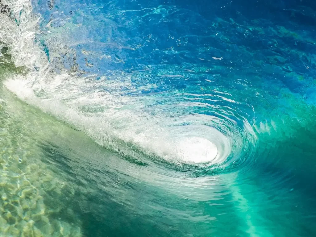
- What to Expect: Wave faces regularly reach 15 to 30+ feet during major swell events. Heavy rip currents, sudden washouts, and massive shorebreak are normal.
- Key Surf Spots: Banzai Pipeline, Sunset Beach, Waimea Bay, Haleiwa.
- Who Should Surf: Advanced, professional, and elite surfers only.
- Pro Tip for Beginners: Keep your feet firmly planted on the dry sand. Watch the spectacular show from the beach. The winter ocean on the North Shore is highly unforgiving.
Summer Surf Forecast (May to September)
In the summer, the northern Pacific goes quiet, and the Southern Hemisphere roars to life. Storms near Antarctica and New Zealand send long-period groundswells traveling thousands of miles up to Hawaii’s southern coastline.
- What to Expect: Consistent, clean, and playful waves ranging from 2 to 6 feet on average. The weather is sunny, and the water is warm.
- Key Surf Spots: Waikiki Beach, Ala Moana Bowls, Diamond Head, Kaiser’s.
- Who Should Surf: Perfect for absolute beginners, longboarders, families, and intermediate surfers looking to improve.
Spring and Fall: The Transition Months
April, September, and October are highly unpredictable but offer incredible rewards.
- What to Expect: You might catch an early winter northwest swell and a late summer south swell on the exact same day.
- The Benefits: The heavy winter crowds haven’t arrived yet (or have just left), and the winds are often light and variable. Locals consider these transition months the sweet spot for balance and comfort.
Detailed Oahu Surf Forecast by Coast
To maximize your surf sessions, you must treat Oahu as four separate micro-climates. Here is how the forecast behaves across each unique coast.

1. The North Shore Forecast
The undisputed capital of worldwide surfing.
- Optimal Swell Angle: Northwest, North-Northwest ($310^\circ – 340^\circ$).
- Optimal Wind: South, Southeast, or light East trade winds (which blow offshore here).
- Reef Profile: Extremely sharp, shallow volcanic shelves with deep underwater caverns.
- Forecast Alert: When the NOAA WaveWatch III model shows an active purple or dark red zone moving toward Hawaii, expect massive closures and heavy beach advisories.
2. The South Shore Forecast
The epicenter of fun, classic longboarding and vibrant surf culture.
- Optimal Swell Angle: South, Southwest, Southeast ($170^\circ – 210^\circ$).
- Optimal Wind: Northeast Trade Winds (perfectly offshore for most town spots).
- Reef Profile: Flat, predictable coral reef structures and gentle sandbars.
- Forecast Alert: Look for long swell periods (16 seconds or higher). Because south swells travel so far, short-period south swells are incredibly rare.
3. The East Side (Windward) Forecast
The most consistent coast on the island for raw wave count.
- Optimal Swell Angle: Direct East Windswell, Northeast groundswell.
- Optimal Wind: Rare West or Southwest winds (Kona winds) make this coast perfectly glassy.
- Reef Profile: Shallow sand channels and outer barrier reefs.
- Forecast Alert: The East Side suffers from constant onshore trade winds. If the forecast predicts light wind days or a shift to internal island breezes, drop everything and head east to spots like Makapu’u or Sandy Beach.
4. The West Side (Leeward) Forecast
A beautiful, highly protective coast that guards hidden gems.
- Optimal Swell Angle: Deep West-Northwest swells or steep Southwest swells.
- Optimal Wind: Clean East trade winds blow perfectly offshore over the mountains.
- Reef Profile: Shallow sand-covered ledges and rocky points.
- Forecast Alert: The West Side is blocked by neighboring islands (Kauai and Niihau) from certain angles. Check the specific swell window degrees carefully before making the long drive out to Makaha.
How to Read Offshore Hawaii Surf Buoys Like a Pro
If you want to beat the crowds and predict the exact hour a new swell will hit, you need to stop looking at standard apps and start tracking the real NOAA Offshore Buoys.

Buoys are floating floating research stations that read true ocean energy before it ever touches land.
[Buoy 51101 / 51001] ---> Reads Raw Pacific Swell ---> 6 to 12 Hours Advance Warning ---> Hits Oahu Beaches
- Buoy 51101 (Northwest Hawaii): Located northwest of the islands. This is your early warning alarm for the North Shore. If this buoy spikes in swell height, you know the North Shore will start growing significantly larger exactly 6 to 9 hours later.
- Buoy 51001 (North of Oahu): Gives a closer look at incoming northern energy.
- Buoy 51002 / 51004 (South Hawaii): Tracks incoming southern hemisphere storms heading up toward Honolulu.
By checking the buoy data online via the National Data Buoy Center (NDBC), you can see real-time increases in wave energy long before the local beach cams show it.
The Best Tools and Apps for Accurate Oahu Surf Tracking
Do not rely on generic weather apps for your surf planning. Use specialized, verified oceanographic data platforms.
- NOAA National Weather Service (Honolulu Marine Printout): The most accurate, zero-hype text forecast. It gives precise marine discussions, wind warnings, and raw buoy metrics straight from government scientists.
- Surfline: Excellent for live HD beach cameras all around Oahu. Great for checking current crowds and wave shapes before leaving your house. (Note: Magicseaweed has fully integrated into the Surfline platform).
- Windfinder / Windguru: The absolute best tools for checking high-resolution hourly wind shifts, wind knots, and precise gust directions across different areas of the island.
3 Critical Surf Forecasting Mistakes to Avoid
Even experienced surfers can misread charts. Avoid these three common pitfalls to save yourself from disappointing sessions or scary situations.
Mistake 1: Only Looking at Wave Height
A forecast that reads “2 feet at 18 seconds” sounds tiny but will produce surprisingly powerful, overhead sets on shallow reef points due to the massive energy stored in the long period. Conversely, a forecast reading “6 feet at 7 seconds” will feel like weak, disorganized, messy wind chop. Always prioritize the swell period over the raw height.
Mistake 2: Ignoring the Wind Knots
If you see a perfect 6-foot groundswell running, but the local wind forecast shows 25-knot onshore winds, the surf will be completely blown out, messy, and hard to paddle through. Look for windows where the wind drops below 10-12 knots for optimal, clean wave faces.
Mistake 3: Forgetting the Tidal Volatility
Some of Oahu’s best spots turn into dry, exposed coral reefs at an extreme low tide. Surfing during these hours can destroy your board fins and cause severe skin scratches. Check the local tide tables to find the sweet spot, which is typically a medium rising tide.
Ocean Etiquette and Safety on Oahu
Forecast data gives you the numbers, but it does not replace real-world common sense and ocean safety.
- When in Doubt, Don’t Go Out: If you arrive at a beach and the waves look significantly larger or more chaotic than what you saw on your computer screen, stay on the beach.
- Talk to the Lifeguards: Hawaii has some of the finest ocean rescue teams in the world. Walk up to the lifeguard stand and ask about current rip currents, hidden rocks, and changing conditions before paddling out.
- Respect the Locals: Oahu lineups can be highly competitive. Never drop in on another surfer, do not backpaddle, and wait your turn patiently at the point.
- Observe Before You Paddle: Spend at least 15 minutes sitting on the beach watching the ocean structure. Identify where the waves are breaking, where the channels are to paddle out cleanly, and how fast the sets are arriving.
Final Thoughts: Read the Chart, Respect the Ocean
An accurate Oahu surf forecast is your most powerful tool for tracking down incredible waves across this beautiful Hawaiian island. By combining swell height, swell period, wind direction, and tidal shifts, you can accurately predict exactly when and where to jump into the water.
Plan your surf days intelligently, pick the right coast for the right season, protect the shallow living reefs, and enjoy the beautiful energy of the Pacific Ocean safely.