Wiliwilinui Ridge Trail: The Complete 2026 Hiking Guide (Permit, Length, Difficulty & Photos)

I still remember the first time I stood at the guard shack on Laukahi Street, sweating a little, wondering if I’d even get a permit to hike Wiliwilinui Ridge Trail. Forty minutes later I was standing above the clouds, looking down at Honolulu on one side and Waimanalo on the other, and I understood immediately why this trail has such a cult following on Oahu.
I’ve hiked it four times now — twice for sunrise, once after a storm rolled through, and once just to test how fast I could move — and this guide covers everything I wish someone had told me before my first trip: the real permit process, exact distance, current difficulty rating, parking situation, safety record, and the best spots for photos.
If you’re building out a full hiking list for your trip, it’s also worth browsing our complete guide to Oahu hikes to see how Wiliwilinui compares to the island’s other top trails.
This isn’t a copy-paste of an old blog post. Everything here reflects what the trail actually looks like as of mid-2026, including the recent storm-related closure and reopening, updated parking rules, and current permit procedures — details a lot of older guides still get wrong.
Quick Facts About Wiliwilinui Ridge Trail
| Detail | Information |
|---|---|
| Location | Waialae Iki, East Oahu, Hawaii |
| Distance | 4.7–4.9 miles round trip (out-and-back) |
| Elevation gain | Roughly 1,325–1,600 ft |
| Difficulty | Moderate to hard |
| Time needed | 3 to 4 hours average |
| Permit | Free, issued on-site by security guard |
| Entrance fee | None |
| Dogs allowed | Yes, on leash |
| Bathrooms | None on trail |
| Best time to start | Before 8 a.m. |
Where Is the Wiliwilinui Ridge Trail Entrance?
The Wiliwilinui Ridge trail entrance sits inside the Waialae Iki 5 neighborhood, a private, guarded community on the eastern side of Oahu, tucked between the Koolau Mountains and Honolulu. This is what surprises most first-timers: you don’t park at a normal trailhead lot. You drive through someone’s neighborhood first.
From Kalanianaole Highway, turn onto Laukahi Street and head mauka, toward the mountains. You’ll hit a guard station before you can go any further. This is the checkpoint where the whole hike either starts smoothly or turns into a waiting game, depending on the day.
Do You Need a Permit for Wiliwilinui Ridge Trail?
Yes — technically it’s a free day pass rather than a formal permit, but functionally it works the same way. Here’s exactly how it works, based on what I’ve experienced every time I’ve gone:
- Pull up to the guard station on Laukahi Street.
- Tell the guard you’re there to hike.
- Show a valid photo ID. The guard records your license plate.
- You receive a laminated day pass with a small map showing where to park.
- On your way out, drop the pass back in the box beside the guard shack.
There is no cost, no advance booking, and no app involved. But here’s the part that trips people up: passes are limited each day, and once they’re gone, you’re turned away or asked to park outside the gated community and walk in, which adds real distance to your hike.
On a recent Saturday visit, the guard told me weekday mornings almost never run out, but weekends by 9 a.m. can already be tight, especially during summer break and holiday weeks.
My tip from experience: arrive before 7:30 a.m. on weekends. I’ve never been denied a pass at that hour, and you also beat the heat and the midday cloud cover that tends to roll in over the summit by early afternoon.
How Long Is the Wiliwilinui Ridge Trail?
This is one of the most searched questions about this hike, and the honest answer is: it depends slightly on which source you check, because trail signage and GPS tracks measure the turnaround point a little differently. Based on GPS data and my own tracked hikes:
- Round trip distance: 4.7 to 4.9 miles
- Elevation gain: approximately 1,325 to 1,600 feet, depending on where you stop
- Average time: 3 to 3.5 hours for most hikers, including breaks
- My fastest time: just under an hour up, roughly 50 minutes back down, moving at a steady trail-running pace
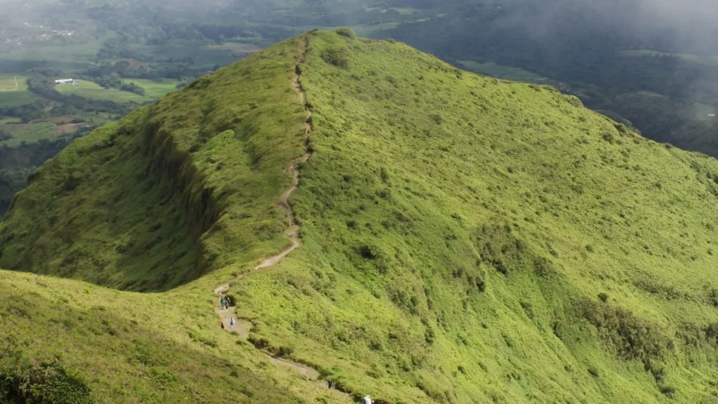
If someone asks “how long is the Wiliwilinui Ridge Trail” in terms of time rather than distance, plan on a half-day outing once you include the permit stop, driving through the neighborhood, and photo breaks at the top. I’ve never done it in under two hours total, even on my quickest attempt.
Wiliwilinui Ridge Trail Difficulty: What to Actually Expect
Most trail apps list this as a “hard” or “moderate to difficult” hike, and having done it multiple times in different conditions, I’d agree with that rating, with a caveat: the first 1.9 miles are genuinely easy.
The hike starts on a paved service road built originally in 1941 by the U.S. Army, which later became a water and power line access road. This section is wide, mostly shaded near the start, and gently graded. If the trail were only this first stretch, I’d call it an easy hike suitable for almost anyone.
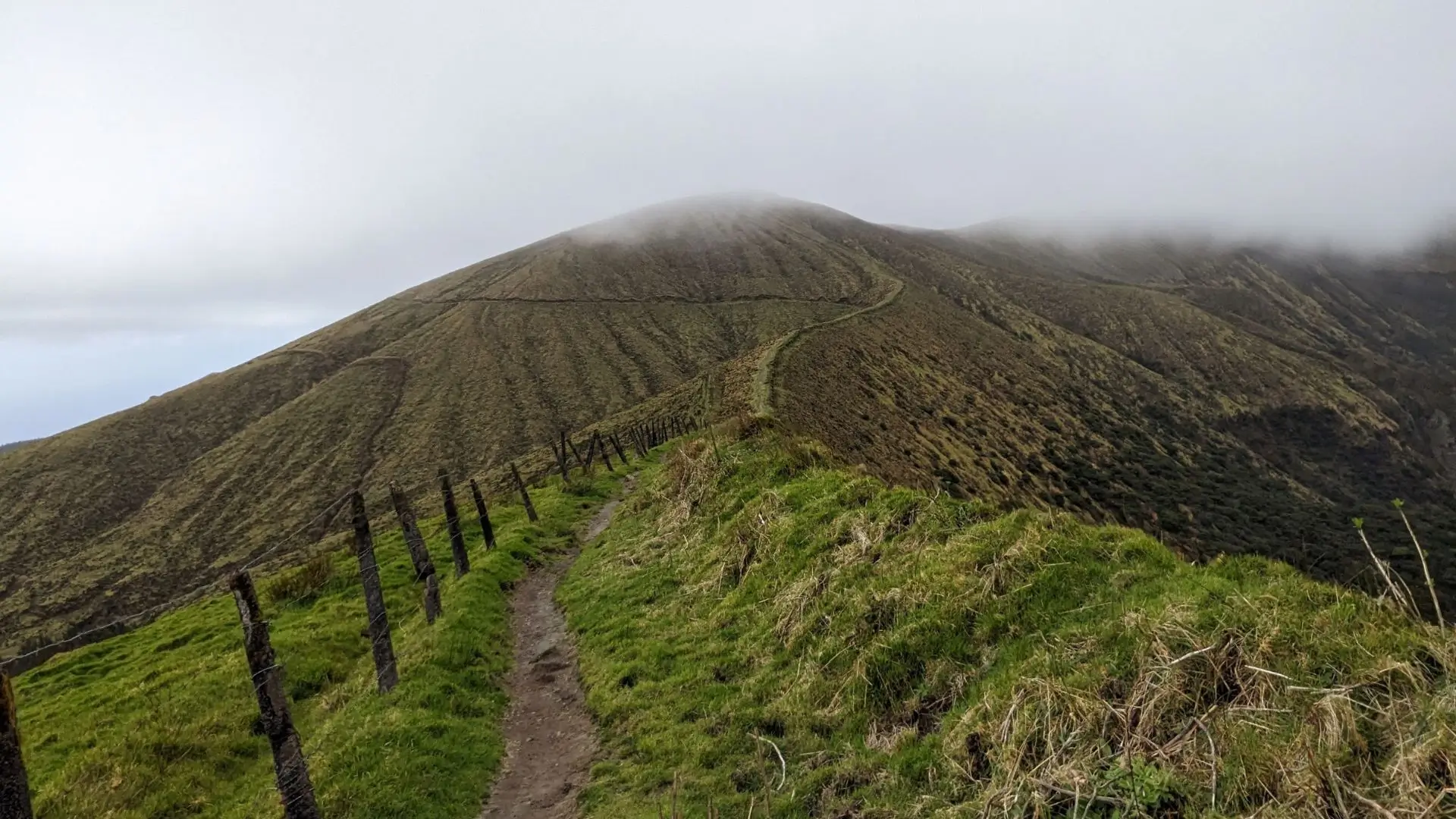
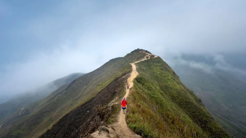
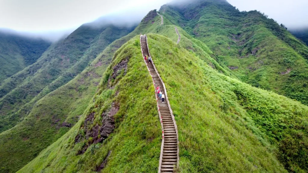
The difficulty ramps up hard in the final stretch. Around the last half-mile to the summit, the trail narrows into a true ridgeline with:
- Steep wooden and dirt stairs
- Fixed ropes bolted in for the steepest sections
- Exposed drop-offs on both sides in a few spots
- Slick, muddy footing anytime it has rained recently (which, on this side of Oahu, is often)
I hiked it once about two days after heavy rain, and that final section turned into a slow, deliberate rope-assisted climb rather than a walk. On a dry day, the same stretch takes a fraction of the time and feels far less intimidating. If you’re a beginner hiker, this trail is doable, but go on a dry day and take the stairs slowly. For comparison, if you want a shorter but steeper stair climb first, our guide to the Koko Head Trail breaks down how that hike stacks up against Wiliwilinui.
Wiliwilinui Ridge Trail Parking: What Nobody Tells You
Parking is the single biggest logistical headache on this hike, more than the trail itself. There are only two small lots near the trailhead, just past where Okoa Street ends, and they fill up fast on weekends.
Here’s what actually happens if the lots are full:
- The guard may direct you to park along the residential streets within Waialae Iki instead
- If the neighborhood itself is at capacity, you’ll be turned away and asked to try another day or another time
- Ride-share pickup and drop-off inside the gated community can be unreliable, since drivers sometimes have trouble navigating the guard checkpoint
Because of this, I never recommend planning a Wiliwilinui hike around a strict schedule. Build in buffer time in case you need to wait for a parking pass, or have a backup trail in mind, like nearby Kuliouou Ridge, in case the lot is full. For more ways to avoid parking headaches across the island, check out our broader Oahu parking tips guide.
Is Wiliwilinui Ridge Trail Dangerous? Looking at the Safety Record Honestly
Oahu’s ridge trails have a well-earned reputation for danger, and it’s worth being straightforward about this instead of glossing over it. Several nearby Koolau ridgeline trails, including Olomana and the Makapuu Tom-Tom trail near Makapuu Point, have had multiple fatal falls over the years, mostly involving hikers going off-trail or hiking unsanctioned, unmaintained routes in wet conditions.
Wiliwilinui, by comparison, has a notably better track record. Based on public safety records and fire department reports, I did not find confirmed reports of a hiker fatality specifically on this trail. What I did find were rescue incidents, which are worth knowing about honestly:
- In March 2025, the Honolulu Fire Department airlifted a hiker in her 20s off the upper trail after she was injured and unable to descend safely on her own.
- There have also been documented rescues involving hikers going off-trail to help a leashed dog that slipped off the ridge, requiring rope rescue systems to bring both back to safety.
The trail is maintained and generally considered one of the safer ridge hikes on this side of Oahu specifically because it’s wider than routes like Olomana. That said, “safer” doesn’t mean risk-free. The exposed final stretch, combined with frequent rain and slick basalt soil, is a real hazard if you’re not careful, especially if you leave the marked path.
My honest safety advice, based on hiking it myself in both dry and wet conditions: check the Oahu weather forecast the morning of your hike, wear real hiking shoes with grip (not running shoes or sandals), use the ropes as intended, and turn around if conditions look unstable.
Also worth noting — the trail, like all forest reserve trails on Oahu, closes during tropical storm or hurricane warnings, and it was closed for a stretch in early 2026 following storm damage. Always check current trail status before you drive out, since conditions can change quickly after heavy rain.
What You’ll See: Photos, Views, and Wildlife Along the Way
If you’re hiking Wiliwilinui mainly for photos, here’s what to expect at each stage, based on my own hikes:
- The first 0.2 miles: paved road passing a water tank, where pavement turns to dirt
- Around 0.8 miles in: your first real glimpse of the summit ridge ahead, and a good early photo spot if clouds are rolling in later
- The muddy left turn: roughly midway, this junction connects toward Wailupe Valley and is one of the muddiest points on the whole route — good to know so you’re not caught off guard
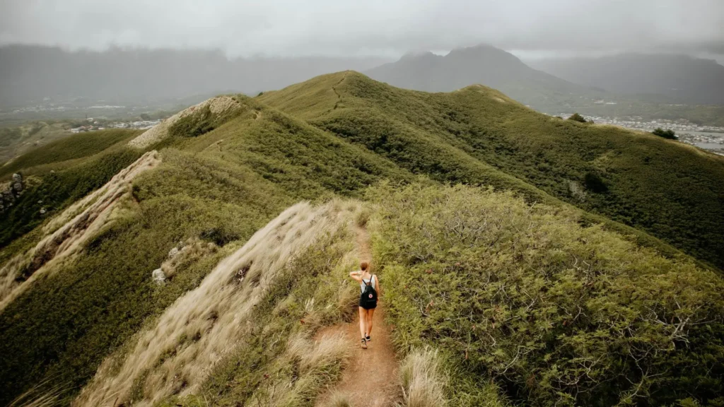
- The final ridge climb: narrow trail, ropes, stairs, and the most dramatic photo opportunities of the whole hike
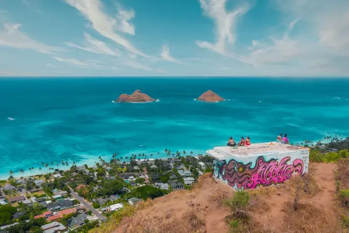
- The summit: 360-degree views spanning Waikiki, Diamond Head, Honolulu’s skyline, the full Koolau summit ridge, Waimanalo, and on a clear day, all the way to Konahuanui
Along the way, the vegetation shifts from introduced guava forest into native koa and uluhe fern forest, and you’ll likely hear (if not spot) native Hawaiian forest birds, which is part of why this trail is also listed on Hawaii’s official birding trail network.

For the best photos, aim for early morning. There’s almost no shade on the ridge itself, and by midday the summit is frequently socked in with clouds, especially in the wetter months. My best photos from all four hikes came from sunrise starts, when the valley below was still catching low light and the summit was clear.
If sunrise hikes are your thing, our roundup of the best places to watch sunrise in Oahu and this list of Oahu photo spots are worth bookmarking for your trip.
What Reviewers Consistently Say
Across major hiking platforms, the pattern in reviews is remarkably consistent: people call it one of Oahu’s best hikes for the effort required, praise the panoramic summit views, and note that it’s relatively uncrowded compared to more famous trails like Diamond Head or Koko Head.
The most common complaints center on the parking pass system and the muddy, technical final stretch after rain, both of which line up exactly with my own experience.
Final Thoughts From Someone Who’s Actually Hiked It
Wiliwilinui Ridge Trail rewards you disproportionately for the effort it asks. The first two miles are approachable enough for a casual hiker, and the final push, while genuinely challenging, is short enough that most reasonably fit people can manage it with proper shoes and a little patience.
The permit system and limited parking are the real obstacles, not the trail itself, so plan your timing around that rather than the hike.
If you go early, check the weather, respect the ropes on the steep sections, and bring enough water, this is one of the most rewarding half-day hikes on Oahu, and one I’ll keep coming back to every time I’m on this side of the island.
FAQS
The first 1.9 miles are easy — a wide, gently graded service road. The last half-mile is genuinely hard: steep stairs, fixed ropes, and a narrow, exposed ridge. Trail apps rate it “hard” overall, mainly because of that final stretch. After rain, it’s harder still.
Yes, but it’s a free day pass, not an advance booking. Show a valid ID to the security guard at the Waialae Iki gate on Laukahi Street and you’re issued a pass on the spot. Passes are limited, so arrive before 7:30 a.m., especially on weekends.
Statewide, that’s usually the Kalalau Trail on Kauai’s Nā Pali Coast. On Oahu, it’s the Olomana Trail. Wiliwilinui is a real challenge, especially near the summit, but it’s better maintained and far less risky than either of those two.
Yes. No entrance fee and no cost for the parking day pass. The only “cost” is potential wait time if passes run out.
Partially. The first 1.9 miles work fine for older kids used to walking. I wouldn’t take young children past that point — the final stretch has steep stairs, ropes, and real exposure on both sides.